Shops and commercial centre between Nepean Highway and Young Street: View north along Nepean Hwy at Davey St and Grand Hotel
Shops and commercial centre between Nepean Highway and Young Street: The Grand Hotel, corner Nepean Hwy and Davey St
Shops and commercial centre between Nepean Highway and Young Street: View south along Nepean Hwy towards Davey St
Shops and commercial centre between Nepean Highway and Young Street: Toilets, view west along Playne St at Nepean Hwy
Shops and commercial centre between Nepean Highway and Young Street: View south along Nepean Hwy at Playne St
Shops and commercial centre between Nepean Highway and Young Street: Shops along east side of Nepean Hwy north of Playne St
Shops and commercial centre between Nepean Highway and Young Street: View north along Nepean Hwy at clocktower towards Wells St
Shops and commercial centre between Nepean Highway and Young Street: View south along Nepean Hwy at clocktower towards Playne St
Shops and commercial centre between Nepean Highway and Young Street: View south along Nepean Hwy between Wells St and Playne St
Shops and commercial centre between Nepean Highway and Young Street: View north along Nepean Hwy at Wells St
Shops and commercial centre between Nepean Highway and Young Street: View south along Nepean Hwy at Wells St
Shops and commercial centre between Nepean Highway and Young Street: Landmark Centre, corner Nepean Hwy and Wells St
Shops and commercial centre between Nepean Highway and Young Street: View south along Nepean Hwy towards Wells St
Shops and commercial centre between Nepean Highway and Young Street: View south along Nepean Hwy between Ross Smith Av and Wells St
Shops and commercial centre between Nepean Highway and Young Street: View south along Nepean Hwy at Ross Smith Av towards Peninsula Centre
Shops and commercial centre between Nepean Highway and Young Street: View north along Nepean Hwy at Ross Smith Av
Shops and commercial centre between Nepean Highway and Young Street: View east along Beach St at Evelyn St
Shops and commercial centre between Nepean Highway and Young Street: View west along Beach St towards walkway overpass at Myer store
Shops and commercial centre between Nepean Highway and Young Street: View west along Beach St at Ross Smith La
Shops and commercial centre between Nepean Highway and Young Street: Myer, inside Bayside Shopping Centre
Shops and commercial centre between Nepean Highway and Young Street: Inside Bayside Shopping Centre
Shops and commercial centre between Nepean Highway and Young Street: View west along Station St Mall at Clyde St
Shops and commercial centre between Nepean Highway and Young Street: View east along Station St Mall
Shops and commercial centre between Nepean Highway and Young Street: View west along Station St Mall towards Bayside Shopping Centre
Shops and commercial centre between Nepean Highway and Young Street: View north along Shannon St Mall towards Bayside Shopping Centre
Shops and commercial centre between Nepean Highway and Young Street: View south along Shannon St Mall towards Wells St
Shops and commercial centre between Nepean Highway and Young Street: View south along Young St at Balmoral St
Shops and commercial centre between Nepean Highway and Young Street: View south along Young St at entrance to Frankston Station
Shops and commercial centre between Nepean Highway and Young Street: View south along Young St at Wells St towards Sentinel sea eagle sculpture
Shops and commercial centre between Nepean Highway and Young Street: View west along Wells St at Young St
Shops and commercial centre between Nepean Highway and Young Street: View west along Wells St west of Young St
Shops and commercial centre between Nepean Highway and Young Street: View east along Wells St at Park La
Shops and commercial centre between Nepean Highway and Young Street: Corner of Wells St and Park La
Shops and commercial centre between Nepean Highway and Young Street: Bayside Entertainment Centre fronting Wells st
Shops and commercial centre between Nepean Highway and Young Street: View east along Wells St at Bayside Entertainment Centre
Shops and commercial centre between Nepean Highway and Young Street: Entrance to cinemas at Bayside Entertainment Centre
Shops and commercial centre between Nepean Highway and Young Street: View south across Wells St at Bayside Entertainment Centre
Shops and commercial centre between Nepean Highway and Young Street: South side of Wells St at Bayside Entertainment Centre
Shops and commercial centre between Nepean Highway and Young Street: Corner of Wells St at Thompson St at Bayside Entertainment Centre
Shops and commercial centre between Nepean Highway and Young Street: View north along Thompson St at Bayside Entertainment Centre towards Wells St
Shops and commercial centre between Nepean Highway and Young Street: Shops along west side of Thompson St
Shops and commercial centre between Nepean Highway and Young Street: View north across Wells St at Shannon St Mall
Shops and commercial centre between Nepean Highway and Young Street: View east along Wells St towards Shannon St Mall
Shops and commercial centre between Nepean Highway and Young Street: View east along Wells St at White St Mall
Shops and commercial centre between Nepean Highway and Young Street: View west along Wells St at Keys St
Shops and commercial centre between Nepean Highway and Young Street: Frankston Business Centre, Young St north of Playne St
Shops and commercial centre between Nepean Highway and Young Street: Corner of Playne St and Young St
Shops and commercial centre between Nepean Highway and Young Street: View east along Playne St at Thompson St
Shops and commercial centre between Nepean Highway and Young Street: View east along Playne St at Nepean Hwy
Views of Frankston Waterfront and Port Phillip from west end of High Street: Northerly view over Frankston Waterfront and beach
Views of Frankston Waterfront and Port Phillip from west end of High Street: View across Kananook Creek towards Landmark Bridge and Frankston Yacht Club
Views of Frankston Waterfront and Port Phillip from west end of High Street: View towards Frankston Pier and Landmark Bridge
Views of Frankston Waterfront and Port Phillip from west end of High Street: View across Pier Promenade towards Landmark Bridge
Views of Frankston Waterfront and Port Phillip from west end of High Street: Westerly view along Pier Promenade towards Frankston Pier
Views of Frankston Waterfront and Port Phillip from west end of High Street: Westerly view towards restaurant at pier
Views of Frankston Waterfront and Port Phillip from west end of High Street: View across Nepean Hwy towards Frankston Pier
Views of Frankston Waterfront and Port Phillip from west end of High Street: View towards coast guard and Frankston Pier
Views of Frankston Waterfront and Port Phillip from west end of High Street: View across Nepean Hwy towards bay
Views of Frankston Waterfront and Port Phillip from west end of High Street: South-westerly view towards Olivers Hill and bay
Frankston Waterfront and Frankston Pier, Pier Promenade: Entrance at corner of Nepean Hwy and Pier Promenade
Frankston Waterfront and Frankston Pier, Pier Promenade: View along Pier Promenade towards restaurant and pier
Frankston Waterfront and Frankston Pier, Pier Promenade: Sofia Restaurant
Frankston Waterfront and Frankston Pier, Pier Promenade: Frankston Visitor Information Centre
Frankston Waterfront and Frankston Pier, Pier Promenade: View towards entrance of pier
Frankston Waterfront and Frankston Pier, Pier Promenade: View along pier near entrance
Frankston Waterfront and Frankston Pier, Pier Promenade: View along pier at entrance
Frankston Waterfront and Frankston Pier, Pier Promenade: View along pier
Frankston Waterfront and Frankston Pier, Pier Promenade: View back along pier towards the beach
Frankston Waterfront and Frankston Pier, Pier Promenade: South-westerly view at end of pier
Frankston Waterfront and Frankston Pier, Pier Promenade: View from pier towards beach to the south
Frankston Waterfront and Frankston Pier, Pier Promenade: View from pier towards coast guard
Frankston Waterfront and Frankston Pier, Pier Promenade: Southerly view along beach from pier
Frankston Waterfront and Frankston Pier, Pier Promenade: Southerly view across beach from pier
Frankston Waterfront and Frankston Pier, Pier Promenade: South-westerly view from pier
Frankston Waterfront and Frankston Pier, Pier Promenade: South-westerly view from pier towards Olivers Hill
Frankston Waterfront and Frankston Pier, Pier Promenade: South-westerly view from pier
Frankston Waterfront and Frankston Pier, Pier Promenade: View from pier towards Landmark Bridge
Frankston Waterfront and Frankston Pier, Pier Promenade: View towards Frankston Life Saving Club and Peninsula Centre from pier
Frankston Waterfront and Frankston Pier, Pier Promenade: View towards pier from beach
Frankston Waterfront and Frankston Pier, Pier Promenade: Lawns near pier
Frankston Waterfront and Frankston Pier, Pier Promenade: Lawns near Landmark Bridge
Frankston Waterfront and Frankston Pier, Pier Promenade: BBQ shelter within lawns near Landmark Bridge
Frankston Waterfront and Frankston Pier, Pier Promenade: Westerly view through lawns towards Landmark Bridge
Frankston Waterfront and Frankston Pier, Pier Promenade: Westerly view along Kananook Creek towards Landmark Bridge
Frankston Waterfront and Frankston Pier, Pier Promenade: Easterly view along Kananook Creek towards Landmark Bridge
Frankston Waterfront and Frankston Pier, Pier Promenade: Northerly view along beach from near pier towards Landmark Bridge
Frankston Waterfront and Frankston Pier, Pier Promenade: View from entrance to Landmark Bridge along beach towards pier
Frankston Waterfront and Frankston Pier, Pier Promenade: Northerly view along Landmark Bridge
Frankston Waterfront and Frankston Pier, Pier Promenade: View from Landmark Bridge towards mouth of Kananook Creek and Frankston Pier
Frankston Waterfront and Frankston Pier, Pier Promenade: Southerly view from Landmark Bridge towards restaurants and lawns
Frankston Waterfront and Frankston Pier, Pier Promenade: View from Landmark Bridge towards lawns on south side of Kananook Creek
Frankston Waterfront and Frankston Pier, Pier Promenade: Easterly view along Kananook Creek from Landmark Bridge
Frankston Waterfront and Frankston Pier, Pier Promenade: North side of Landmark Bridge
Frankston Waterfront and Frankston Pier, Pier Promenade: View north along beach at Frankston Yacht Club
Frankston Waterfront and Frankston Pier, Pier Promenade: View south along beach towards Frankston Yacht Club and Landmark Bridge
Kananook Creek Reserve: Boat launching ramp near McCombs Reserve
Kananook Creek Reserve: Jet skiers on Kananook Creek near boat launching ramp
Kananook Creek Reserve: Boat hire area, Kananook Creek south of Davey St
Kananook Creek Reserve: Frankston Anglers & Boat Owners Club, west side of Kananook Creek
Kananook Creek Reserve: View east along boardwalk through reserve towards Davey St
Kananook Creek Reserve: Picnic areas in reserve opposite Davey St
Kananook Creek Reserve: View east along bridge over Kananook Creek at Davey St
Kananook Creek Reserve: View north along Kananook Creek at Davey St
Kananook Creek Reserve: View through reserve opposite Playne St
Kananook Creek Reserve: View south along Kananook Creek south of Wells St
Kananook Creek Reserve: View south along Kananook Creek from bridge at Wells St
Kananook Creek Reserve: View east along bridge over Kananook Creek at Wells St
Kananook Creek Reserve: View south along Kananook Creek from footbridge at Beach St
Kananook Creek Reserve: Footbridge over Kananook Creek at Beach St
Beach between Frankston Life Saving Club and Kananook Creek: Frankston Life Saving Club viewed from car park
Beach between Frankston Life Saving Club and Kananook Creek: View to beach from Frankston Life Saving Club
Beach between Frankston Life Saving Club and Kananook Creek: View of Frankston Life Saving Club from beach
Beach between Frankston Life Saving Club and Kananook Creek: View north along beach at Frankston Life Saving Club
Beach between Frankston Life Saving Club and Kananook Creek: View south along beach
Beach between Frankston Life Saving Club and Kananook Creek: Stairway to beach viewing platform from boardwalk through Kananook Creek Reserve
Beach between Frankston Life Saving Club and Kananook Creek: Beach viewing platform
Beach between Frankston Life Saving Club and Kananook Creek: View north along foreshore and beach towards Frankston Life Saving Club
Beach between Frankston Life Saving Club and Kananook Creek: View north along beach towards Frankston Life Saving Club
Beach between Frankston Life Saving Club and Kananook Creek: View south along beach towards Frankston Yacht Club
Beach between Frankston Life Saving Club and Kananook Creek: View along beach towards Frankston Pier
Beach between Frankston Life Saving Club and Kananook Creek: View across foreshore towards Frankston Pier
Beach between Frankston Life Saving Club and Kananook Creek: South-westerly view towards Frankston Pier and Olivers Hill
Beach between Frankston Life Saving Club and Kananook Creek: View south along coastal boardwalk towards Frankston Life Saving Club
Beach at end of Beach Street: Western end of Beach St
Beach at end of Beach Street: View across foreshore towards Frankston Pier
Beach at end of Beach Street: View along beach towards Frankston Pier and Olivers Hill
Beach at end of Beach Street: View south along beach towards Frankston Life Saving Club
Beach at end of Beach Street: View across beach towards Frankston Yacht Club and Landmark Bridge
Beach at end of Beach Street: Northerly view along foreshore and beach
Beach at end of Allawah Avenue: Pathway through foreshore
Beach at end of Allawah Avenue: View towards beach from foreshore path
Beach at end of Allawah Avenue: View south along foreshore and beach
Beach at end of Allawah Avenue: Bathing boxes and sheds on foreshore
Beach at end of Allawah Avenue: View south along beach
Beach at end of Allawah Avenue: View across beach towards Frankston Waterfront area
Beach at end of Allawah Avenue: View across beach towards Frankston Pier
Beach at end of Allawah Avenue: View south along beach
Beach at end of Allawah Avenue: Northerly view along beach
Kananook Creek at Allawah Avenue: Footbridge across Kananook Creek
Kananook Creek at Allawah Avenue: View south along Kananook Creek from footbridge
Northern section of Nepean Highway: Avenue of Honour war memorial, view south along Nepean Hwy south of Allawah Av
Northern section of Nepean Highway: Welcome to Frankston sign, view south along Nepean Hwy south of Overton Rd
Northern section of Nepean Highway: Roadside Marker sculpture, Nepean Hwy at Gould St
Foreshore boardwalk and beach south of Frankston Pier: View along boardwalk between pier and coast guard
Foreshore boardwalk and beach south of Frankston Pier: Playground and picnic area at coast guard
Foreshore boardwalk and beach south of Frankston Pier: Playground at coast guard
Foreshore boardwalk and beach south of Frankston Pier: View towards pier from boardwalk
Foreshore boardwalk and beach south of Frankston Pier: Southerly view along boardwalk
Foreshore boardwalk and beach south of Frankston Pier: View along boardwalk towards shaded viewing platform
Foreshore boardwalk and beach south of Frankston Pier: View north along boardwalk towards pier
Foreshore boardwalk and beach south of Frankston Pier: View across foreshore and bay towards Olivers Hill
Foreshore boardwalk and beach south of Frankston Pier: View across beach towards Olivers Hill
Foreshore boardwalk and beach south of Frankston Pier: Southerly view along beach
Southern section of Nepean Highway: View south-west along Nepean Hwy at Liddesdale Av
Southern section of Nepean Highway: View north-east along Nepean Hwy at Liddesdale Av
Southern section of Nepean Highway: View south-west along Nepean Hwy towards Fernery La
Jetty and boat ramp opposite Liddesdale Avenue: View along jetty out into bay
Jetty and boat ramp opposite Liddesdale Avenue: View from jetty towards boat ramp
Jetty and boat ramp opposite Liddesdale Avenue: View from jetty towards car park
Jetty and boat ramp opposite Liddesdale Avenue: View from jetty towards Olivers Hill
Jetty and boat ramp opposite Liddesdale Avenue: Coastline at western end of car park
Jetty and boat ramp opposite Liddesdale Avenue: View across Nepean Hwy towards boat ramp and jetty
Jetty and boat ramp opposite Liddesdale Avenue: View south-west along access road
Jetty and boat ramp opposite Liddesdale Avenue: View north-east along access road
Jetty and boat ramp opposite Liddesdale Avenue: View towards beach from eastern end of access road
Olivers Hill, Nepean Highway: View across bay towards Frankston Waterfront and Peninsula Centre
Olivers Hill, Nepean Highway: View across bay towards Frankston Pier
Olivers Hill, Nepean Highway: View down to car park at boat ramp
Olivers Hill, Nepean Highway: View down to jetty and boat ramp
Olivers Hill, Nepean Highway: North-easterly view across bay
Olivers Hill, Nepean Highway: View along Nepean Hwy descending down Olivers Hill
Olivers Hill, Nepean Highway: View along walking track descending down Olivers Hill
Olivers Hill, Nepean Highway: View from car park at lookout
Olivers Hill, Nepean Highway: View across bay
Olivers Hill, Nepean Highway: South-westerly view along coast
Davey Street: Commonwealth Centre, corner Davey St and Young St
Davey Street: Entrance to Frankston Civic Centre
Davey Street: War memorial at Frankston Civic Centre
Davey Street: Frankston Arts Centre
Churches and education: 'C' building at Chisholm Institute, Quality St
Churches and education: Uniting Church, High St opposite Bay St South
Churches and education: St Pauls Anglican Church, Bay St South
Frankston Park: Entrance to Frankston Park, corner Plowman Pl and Bay St South
Frankston Park: Bryan Mace Grandstand
Frankston Park: Football club buildings along oval
Beauty Park: Pathway along High St
Beauty Park: 
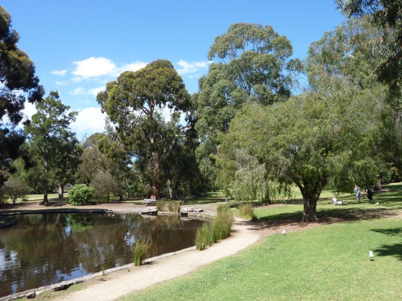
View across lake towards High St
Beauty Park: Viewing platforms overlooking lake
Beauty Park: Viewing platform at lake
Beauty Park: Power of Community mosaic sculpture at north-west corner of lake
Beauty Park: View from north side of lake
Beauty Park: Car park along north side of lake
Beauty Park: BBQ and picnic shelter
George Pentland Botanic Gardens: Entrance gate at corner of Williams St and Foot St
George Pentland Botanic Gardens: Fernery near entrance gate
George Pentland Botanic Gardens: Information shelter
George Pentland Botanic Gardens: Picnic area
George Pentland Botanic Gardens: Playground
George Pentland Botanic Gardens: Lawns near playgrounds
George Pentland Botanic Gardens: Lake
George Pentland Botanic Gardens: Lawns at lake
George Pentland Botanic Gardens: Pathway near lake
George Pentland Botanic Gardens: Fern Gully Walk
George Pentland Botanic Gardens: Wood carvings along Fern Gully Walk
Frankston Freeway: View south-east along Frankston Fwy at Skye Rd
Shops at eastern end of Beach Street: Shops on corner of Ashleigh Av and Beach St
Shops at eastern end of Beach Street: View south-east along Beach St
Shops at eastern end of Beach Street: Shops along service road
Shops at eastern end of Beach Street: View north-west along service road near Frawley St
Jubilee Park: Jubilee Park Aquatic Centre
Jubilee Park: View across football and cricket oval towards aquatic centre
Jubilee Park: BBQ and picnic area beside Adrian Butler Oval
Jubilee Park: Adrian Butler Oval and pavillion
Jubilee Park: View across Adrian Butler Oval
Jubilee Park: Football and cricket oval
Jubilee Park: View south from Nursery Av towards football and cricket oval
Ballam Park: View through park from car park fronting Cranbourne Rd
Ballam Park: BBQ and picnic area at car park
Ballam Park: BBQ and picnic area
Ballam Park: Pathway at car park
Ballam Park: Fountain
Ballam Park: Pathway through park
Ballam Park: Footbridge
Ballam Park: Amphitheatre overlooking playground
Ballam Park: Playground
Ballam Park: Playground and shelter
Ballam Park: Lawns beside entrance to Ballam Park Homestead
Ballam Park: Pavillion at rugby field
Ballam Park: Rugby field
Ballam Park: Athletics field
Ballam Park Homestead, Cranbourne Road: Driveway entrance
Ballam Park Homestead, Cranbourne Road: Front of homestead
Ballam Park Homestead, Cranbourne Road: Gardens at front of homestead
Ballam Park Homestead, Cranbourne Road: Courtyard at rear of homestead
Ballam Park Homestead, Cranbourne Road: Garden at rear of homestead
Ballam Park Homestead, Cranbourne Road: Outbuildings at rear of homestead
Ballam Park Homestead, Cranbourne Road: Cafe
Ballam Park Homestead, Cranbourne Road: Old farming equipment display shelter
Centro Karingal, Cranbourne Road: Shopping centre entrance at post office
Shaxton Circle: Shops along Heatherhill Rd
Shaxton Circle: Parkland along Shaxton Circle opposite Heatherhill Rd
Shaxton Circle: Shaxton Circle Lake
Shaxton Circle: Shaxton Circle Lake and island
Sweetwater Creek Nature Reserve: Walking track at Liddesdale Av near Nepean Hwy